
Global Event: Sydney’s environmental heritage – Ku-ring-gai
Visit 2025 World Environment Day map and see FOKE’s events shared with the world!
When:

Friends of Ku-ring-gai Environment (FOKE) is a community voluntary organisation that advocates for the preservation, protection and rehabilitation of Ku-ring-gai’s unique heritage and environment.
Founded in 1994 to protect the Ku-ring-gai’s 20th Century heritage that is a unique blend of the natural and built form (and which has been described as the best domestic 20th Century domestic architecture in Australia), FOKE has been a leading voice against the cumulative impacts of overdevelopment on Ku-ring-gai’s heritage and environment.
FOKE continues to actively campaign for stronger heritage and environmental protections based on ecologically sustainability principles.
One of FOKE’s project is working towards a UNESCO Ku-ring-gai GeoRegion. Visit the Ku-ring-gai GeoRegion website HERE.
FOKE puts the case that the environment of Ku-ring-gai has global, national, state and local significance. It is an exemplar of Sydney’s environmental heritage.
PO Box 584 Gordon NSW 2072; Tel: (02) 9416 9007: Web: www.foke.org.au; Email: info@foke.org.au; Facebook: Friendsofkuringgai
President: Kathy Cowley; Vice-President: Janine Kitson; Treasurer: Tanya Wood; Minutes Secretary: Katrina Pickles; Committee: :Christiane Berlioz, Joy Bryan, Ursula Bonzol, Carolyn Darby, Janet Harwood, Denise Hendy, Julie McArdle
Acknowledgement of Country:
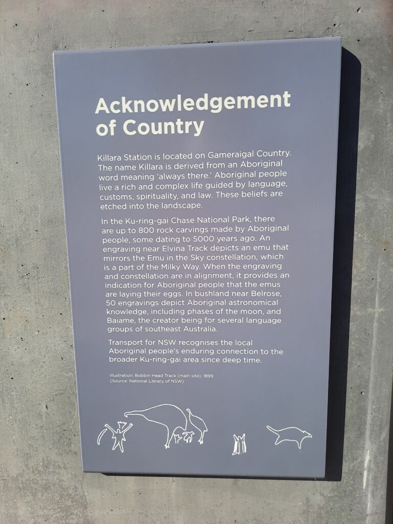
FOKE acknowledges the Darramuragal, Darug and Gameraigal people as the traditional custodians of the land on which Gordon, Killara, Lindfield and Roseville stands, paying respect to Elders past, present, and emerging (see plaques at Killara and Roseville Railway Stations).
For tens of thousands of years, the Darramuragal, Darug, Gameraigal have nurtured this Country, traversing its tracks and ridgelines and canoed its riverways to connect communities and sustain their cultural practices. We express deep regret for the profound loss and disruption the Darramuragal, Darug, Gameraigal experienced when timber cutters cleared their forests, altered the fire regime, and took this land for farming, and disregarded their deep spiritual and cultural connection to Country.
The first land grants were made in 1821. Land was used mainly for timber-getting until the 1840s. After 1840, with the clearing of the valuable timber, orchards and farms were established
Unlike modern economic notions of ownership, the Darramuragal, Darug, Gameraigal people lived in harmony with the land, without attachment to possession. They also had a profound understanding of the environment.
We are grateful that their forests have regrown that foster a strong affinity for place amongst the many who now live in Ku-ring-gai.
We pay tribute to their, up to 800 rock carvings with some dating back to 5000 years ago in the Ku-ring-gai Chase National Park.
We commit to respecting their ongoing connection to this land, its tall Blue Gum High & Sydney Turpentine Ironbark forests, waterways and wildlife.
About the UN Environment Programme
The UNEP is the leading global voice on the environment. It provides leadership and encourages partnership in caring for the environment by inspiring, informing and enabling nations and peoples to improve their quality of life without compromising that of future generations. See the United Nations Environment Programme website HERE

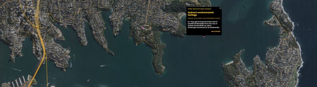
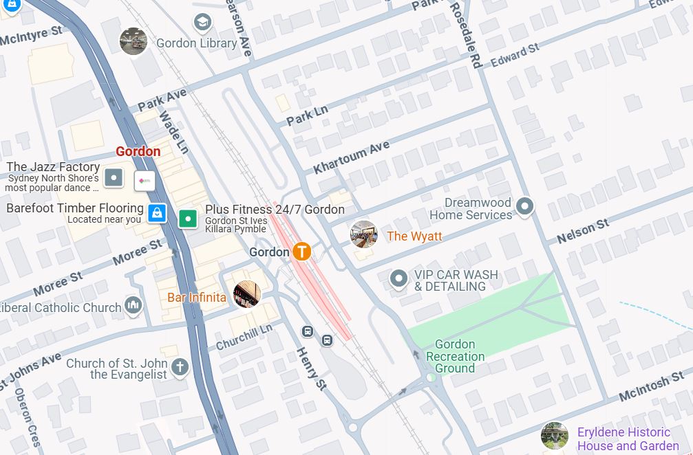
Meet: Annie Wyatt Park, cnr of St Johns Avenue & Henry Street, Gordon (opposite Gordon Railway Station)
Start: 9.45am for 10am start. Finish: around 1pm
Itinerary: Annie Forsyth Wyatt Garden, Gordon Railway Station, catch train to Killara, Killara Railway Station, catch train to Lindfield, Lindfield Station, catch train to Roseville, Roseville Railway Station, catch return train to Gordon, Concluding words at Gordon Railway Station.
Housekeeping:
- Bring your water, hat and wear comfortable shoes.
- Bring your Opal Card, as the tour involves train travel from Gordon to Roseville.
- Toilets are available at Gordon, Killara, Lindfield and Roseville railway stations.
Gordon
Annie Forsyth Wyatt Garden
Corner of Henry Street and St Johns Avenue, Gordon

ANNIE FORSYTH WYATT GARDEN,
FOUNDER OF THE NATIONAL TRUST OF AUSTRALIA (NSW).
In the 1930s a number of trees were planted on this site by the newly formed Ku-ring-gai Tree Lovers’ Civic League and its founding member – Annie Forsyth Wyatt OBE.
While residing in Gordon with her husband and two young children, Annie was dismayed by the amount of land clearing occurring in the area and the local authority’s dumping of rubbish behind her house. In 1927 Annie set up the Ku-ring-gai Tree Lovers’ Civic League after a meeting at her house with like-minded, concerned locals. The objective of the League was ‘safe guarding the natural charms of the municipality’. The group begun actively campaigning against tree clearing, rubbish dumping and the sale of public bushland. The League’s education program at local schools and increased public profile led to requests for their involvement in protest beyond Ku-ring-gai and branches the League were set up throughout Australia over the next 45 years.
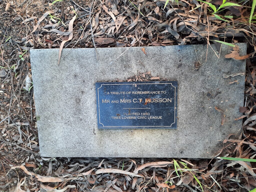
The Lemon Scented Gum which now dominates this garden was planted by the League in 1930 to commemorate the respected botanist Charles Musson of Gordon and his wife Ada. Three years later the sandstone seat in the park was presented as a gift to the citizens of Ku-ring-gai and as a memorial to the botanist Richard Cambage.
Annie had a keen interest in the preservation of the nation’s built heritage. The loss of a number of Sydney colonial building throughout the early 20th century highlighted the lack of protection afforded to conservation in heritage. Inspired by the work of the British National Trust, Annie floated the idea for the creation of an Australian equivalent at the 1944 Forest League (NSW) Conference. The proposal was adopted unanimously and the Australian National Trust of Australia (NSW) was established in 1945 with Annie as its founding member and first Honorary Secretary.
Continued campaigning by the Trust raised public awareness about Sydney’s valuable built heritage and natural environment. The Trust’s work help prevent the demolittion of numerous landmarks throughout Sydney , including important Macquarie Street strictuires such as Hyde Park Barracks, Parliament House and he Mint which were threatened with redevelopment. Annie’s achievements in set up the Trust and n her lifetime of advocacy for heritge conservation were recognised with her appointment as an OBE in 1960, an honour that her son Ivor Jnr was also later awarded. Annie Forsyth Wyatt continued her determined work with the National Trust up until she passed away at her St Ives home in 1961.
‘Mrs A.F. Wyatt is held in great esteem for the part she played in preserving New South Wales’ fauna, flora, and places of natural beauty.’ – OBE Synopsis, Queens Birthday Honours 1960.
Annie Wyatt was also very well connected and knew other conservationists of her time including Professor Waterhouse, Charles Bean, David Stead (marine biologist) and Myles Dunphy.
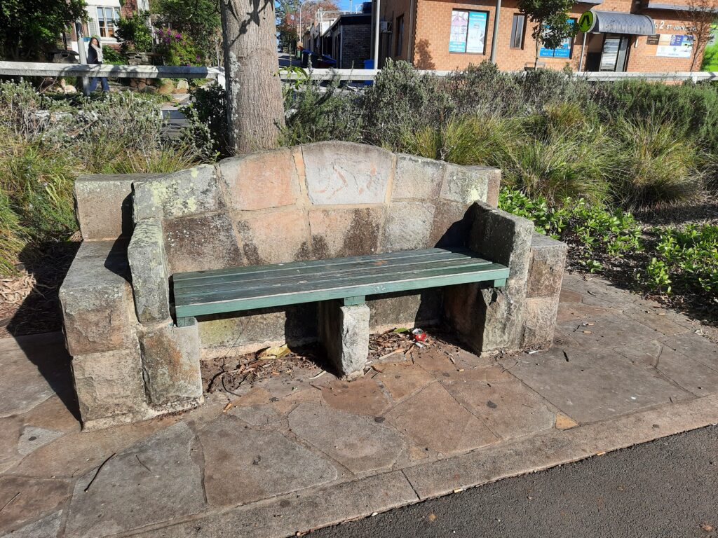
1933 the Ku-ring-gai Tree Lovers’ Civic League presented this sandstone seat as a gift to the citizens of Ku-ring-gai and as a memorial to the botanist Richard Cambage (1859-1928).
Richard Cambage made important contributions to the description of the general Acacia and Eucalyptus.
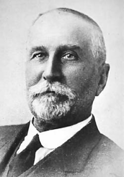
Richard Cambage (1859-1928) contributed to the Linnean Society a series of “Notes on the Botany of the Interior of New South Wales” from 1901-1903 as well as “Notes on the Native Flora of New South Wales”,(1901-1903) published for more than 20 years. He was secretary of the Royal Society of New South Wales from 1914-1922 and from 1925-28. He was president in 1912 and 1924.
He was also involved in the Australian National Research Council, the Australasian Association for the Avancement of Science, the NSW Forest League and Australian Wattle League and Royal Historical Society.
Acacia cambagei and Eucalyptus cambageana are named after him
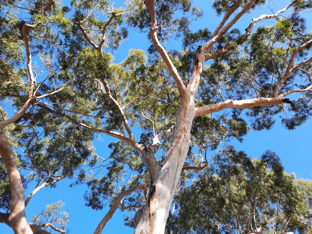
The Lemon Scented Gum (Corymbia citrodora) which now dominates this garden was planted by the Ku-ring-gai Tree Lovers’ Civic League in 1930 to commemorate the respected botanist Charles Musson of Gordon and his wife Ada.
This Lemon Scented Gum (Corymbia citrodora). This tree removes 5185g of pollution each year (Killior’ra Tree Trail).
Charles Musson was a naturalist and teacher who for nearly 30 years taught science subjects (largely botany and entomology) at the Hawkesbury Agricultural College in NSW. He was an enthusiastic advocate for the study of nature, particularly ecological and environmental aspects. Musson published prolifically on a wide range of natural history subjects (including weeds, seed testing, shells and birds) in scientific journals and popular magazines. For 40 years he was a Fellow of the Linnean Society of NSW. He lived in Nelson Street, Gordon.

The National Trust of Australia (NSW)
Community Groups including
STEP Inc
Friends of Ku-ring-gai Enviroment Inc
The Blue Gum High Forest Group
St Ives Progress Association
The National Trust Diamond Jubilee 1945 to 2005
This Sydney Blue Gum (Eucalyptus saligna) was planted to honour Annie Forsyth Wyatt OBE, tree lover, humanitarian and founder of The National Trust of Australia NSW
” … the ability to dream and see purpose to carry them to fulfilment” “. – Annie Forsyth Wyatt’s writing in 1938 of qualities she admired..
The Hon. Barry O’Keefe AM OC President of the National Trust of Australia NSW
Counsellor Adrienne Ryan, Mayor of Ku-ring-gai
Mrs Nancy Pallin 2005 awardee for outstanding service to the Ku-ring-gai
THIS DAY SATURDAY 9 APRIL 2005
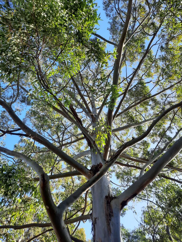
Scientific name: Blue Gum High Forest in the Sydney Basin Bioregion
Conservation status in NSW: Critically Endangered Ecological Community
Commonwealth status: Critically Endangered
More information on Blue Gum High Forest (BGHF)
View Blue Gum High Forest fact sheet(PDF, 369KB)
BGHF is named for the Sydney Blue Gum, one of the most common trees found in the forest, reaching heights of up to 30 metres. The forest provides important habitat and shelter for native animals such as the Grey-headed Flying Fox and Glossy Black Cockatoo – both endangered species.
Once covering large areas of the shale-capped ridge tops of northern Sydney, less than five per cent of BGHF now remains, restricted to the shale soils of Northern Sydney around Pennant Hills, Epping and parts of Ku-ring-gai. The largest surviving remnant of BGHF is in St Ives around Dalrymple-Hay Nature Reserve and Browns Forest.
You can walk among the majestic Sydney Blue Gums and Blackbutts of Dalrymple-Hay Reserve and Browns Forest, seeing the landscape as the Aboriginal and early European settlers would have seen.
An ecological community is listed as critically endangered if The Threatened Species Scientific Committee (TSSC) has determined that Sydney Blue Gum High Forests faces an extremely high risk of extinction in Australia in the immediate future.
It is threatened as a result of clearing, fragmentation and pressures from the surrounding environment, such as weeds, nutrient run off and sedimentation.
Looking down bushland path to Henry Street (south)
Importance of restoration bushland
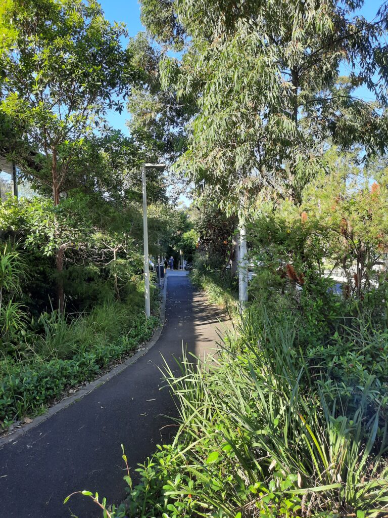
Restoration of a small bushland wildlife corridor
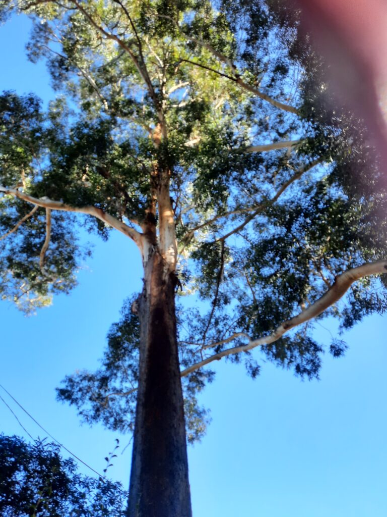

Blackbutts on corner of Henry Street and Ravenswood Avenue, Gordon
Looking up towards St Johns Avenue


Sydney Turpentine tree, St Johns Avenue, Heritage Park

Gordon Railway Station is close to the Pacific Highway, that is on the North Shore ridgeline. On the western side of this ridgeland it drops steeply towards the Lane Cove River.
Find out how Ku-ring-gai Council is greening our streets and reducing stormwater runoff.
World Environment Day, the United Nations Environment Programme (UNEP) and the host nation, the Republic of Korea, are mobilizing communities across the globe to #BeatPlasticPollution.
UN Secretary-General António Guterres’s Video Message for World Environment Day 2025:
This World Environment Day focuses on solutions to beat plastic pollution.
And rightly so.
Plastic pollution is choking our planet – harming ecosystems, well-being, and the climate.
Plastic waste clogs rivers, pollutes the ocean, and endangers wildlife.
And as it breaks-down into smaller and smaller parts, it infiltrates every corner of Earth: from the top of Mount Everest, to the depths of the ocean; from human brains; to human breastmilk.
Yet there is a movement for urgent change.
We are seeing mounting public engagement…
Steps towards reusability and greater accountability…
And policies to reduce single-use plastics and improve waste management.
But we must go further, faster.
In two months, countries will come together to hammer-out a new global treaty to end plastic pollution.
We need an ambitious, credible and just agreement this year.
One that covers the life-cycle of plastic, through the perspective of circular economies…
That responds to the needs of communities…
That aligns with broader environmental goals, the sustainable development goals, and beyond…
And that is implemented fast and in full.
I urge negotiators to return to talks in August determined to build a common path through their differences and deliver the treaty our world needs.
Together, let’s end the scourge of plastic pollution and build a better future for us all.
Thank you.
Gordon Railway Station

The North Shore railway line was Sydney first purely suburban railway and opened as a 16.8 km single line between Hornsby and St. Leonards (now North Sydney)in 1890. Railway stations were constructed at Gordon as well as Chatswood, Roseville, Lindfield, Pumble, Turramurra (formerly Eastern Road Station) and Wahroonga (formerly Pearce’s Corner Station). The construction of Gordon Railway Station increased land values in the surrounding area. Existing rural plots were subdivided due to the demand for high elevated land with clean air, located within easy reach of the city by rail.
By 1909 the line from Hornsby to Milson’s Point with duplicated, with the existing station platforms and buildings upgraded to handle the additional line infrastructure. A number of new stations include Waitara, Warrawee, Killara and Artarmon were also constructed during this time. In 1909, the original single platform in timber building were replaced by a new island platform with brick building an integrated signal box. This brick building can still be seen today.
The new island platform served the Up North Shore line and the Down North Shore line. A third platform was built which allowed for the termination of local trains at Gordon. The overhead steel footbridge and booking office were completed by 1910 and allowed local residents to have staircase access to the platforms from the surrounding streets.
The North Shore line with electrified in 1927 and in 1928 automatic signalling was installed. In 1932, the opening of the Sydney Harbour Bridge allowed the Northern and Southern shores of the Sydney Harbour to be linked by rail.
On August 18th 1922, a train derailed it Gordon Station. The cause was later found out to be a piece of iron that had been placed on the track in a deliberate attempt to wreck the train. Fortunately there were no injuries reported from the 60 to 70 passengers on board.
On Friday, March 15th 1935, a train crash occurred near Gordon station just after 5am when a passenger train collided with a good strain. The damage to vehicles was estimated at more than 6000 pounds and fortunately, there was no fatalities.
The station has had a number of upgrades and access improvements in recent years including to the footbridge and booking office, with lift access to the platform provided in 2006. Gordon Railway Station is listed on the State Heritage Register for its historic, aesthetic and social significance.
Gordon Railway Station Group is significant at a state level at a state level as an excellent example of an early 20th century suburban station building group located on the North Shore Line, which retains the high degree of integrity and quality in its architectural design.
Gordon Railway Group Statement of significance, NSW Office of Environment & Heritage

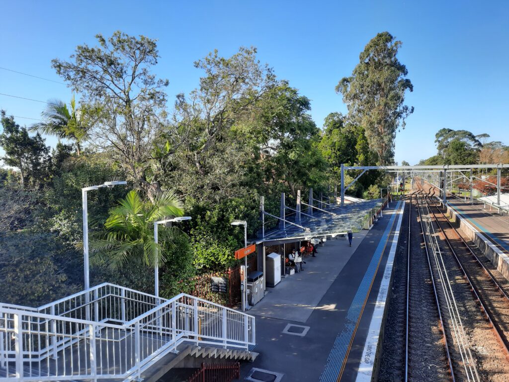
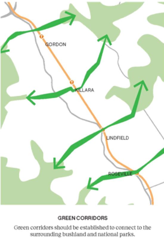
Gordon Railway Station is part of a north-south environmentally sensitive corridor
This wildlife corridor supports biodiversity including its Critically Endangered Blue Gum High Forest and Sydney Turpentine Ironbark Forest (STIF).
Ku-ring-gai has four endangered ecological communities and two critically endangered, under the NSW Biodiversity Conservation Act 2016.
An ecological community is listed as critically endangered if the Threatened Species Scientific Committee (TSSC) determines it is facing an extremely high risk of extinction in Australia in the immediate future.
Threats to these communities have been the result of clearing, fragmentation and pressures from the surrounding environment, such as weeds, nutrient run off and sedimentation.
Urban deforestation is being fuelled by the NSW Government State Environment Planning Policies – or SEPPs – (Transport Oriented Development, Low to Mid Rise Housing, State Significant Planning Developments, Housing Delivery Authority)
Environmentally sensitive railway corridor
- Gordon Railway Station Group, STATE Heritage listed. St Johns Ave, Gordon, 02 9847 8458
- Close proximity to Pacific Highway. Air Quality: Fuel cars are a major contributor to air pollution. Burning gasoline and diesel in internal combustion engines releases various pollutants, including carbon dioxide, nitrogen oxides, and particulate matter, which negatively impact air quality.
- RIdgeline. Views to the Blue Mountains – a river; Eccleston du Faur inspired by it and led him to work to created the Ku-ring-gai Chase National Park; Alex Colley 2000 – World Heritage listed it
- Cloxe proximity to Mona Vale Road, the road that leads from forests to the ocean
- Hawkesbury RIver – north
- Sydney Harbour – south
- Lane Cove RIver – west
- Middle Harbour – east
- The railway line was part of Ku-ring-gai’s transformation into a garden suburb. The railway was crucial for commuters, aligning with town planner John Sulman’s vision for Ku-ring-gai as a garden suburb
- 1927 electrification of line in preparation for opening of Sydney Harbour Bridge
- 2014, the bus stop on the station’s western side was demolished to make way for a three-storey carpark and bus interchange. The new interchange opened in early June 2015
- Gordon Station is part of Ku-ring-gai’s Green Corridors, supporting biodiversity including its Critically Endangered Blue Gum High Forest and Sydney Turpentine Ironbark Forest (STIF)
- Views – Garigal National park, Northern Beaches Hospital
- Finger bushlands valleys that lead to the national parks
- Ku-ring-gai is a national park catchment
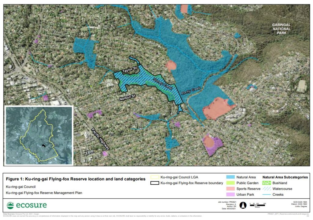
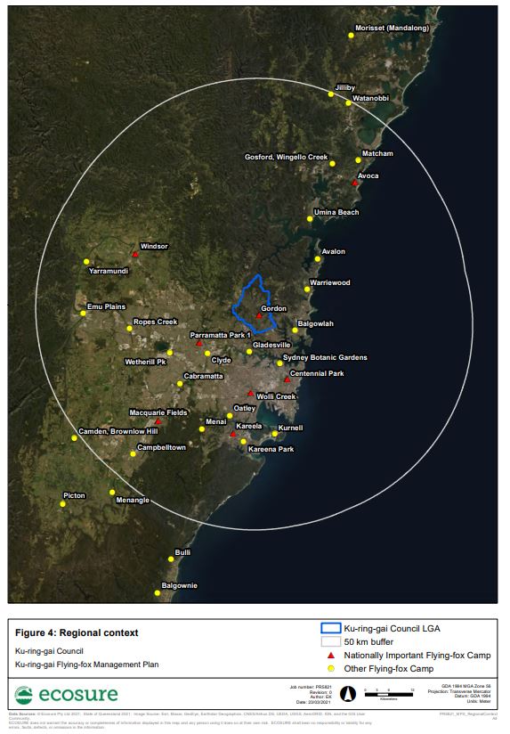
- Gordon Bat Colony
- Powerful Owl
- Burgoyne Street SSD
Ku-ring-gai Bat Colony and nesting of Powerful Owls
Sydney Turpentine-Ironbark Forest
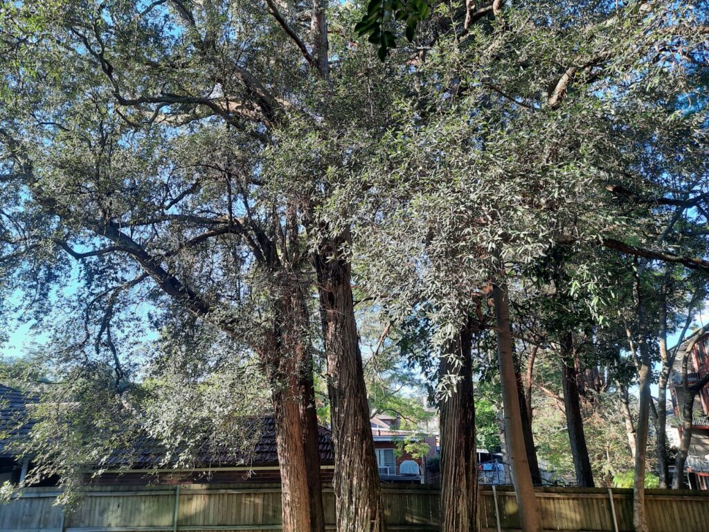
Sydney Turpentine-Ironbark Forest (STIF) is often found on the edges of Blue Gum High Forest and is dominated by Turpentine, Eucalypts and Ironbarks, together with smaller trees such as the Parramatta Wattle and White Dogwood, and a mixture of grasses.
Communities listed as critically endangered are deemed to be facing an extremely high risk of extinction in the near future.
This forest provides layers of habitat for wildlife, with mature trees providing nest hollows for Australia’s largest owl – the Powerful Owl and also for the Glossy Black-Cockatoo.
The combined area of STIF and BGHF once covered 46,000 hectares, but just 0.5 per cent of the original STIF remains in Ku-ring-gai due to land clearing. In Ku-ring-gai it is found along Mona Vale Road, St. Ives, the southern end of Fox Valley Road and Bicentennial Park.
Killara

Killara Railway Station is the most distant railway station from Pacific Highway. Regardless it is still close to the Pacific Highway.
Killara Railway Station is part of a north-south environmentally sensitive corridor.
This wildlife corridor supports biodiversity including its Critically Endangered Blue Gum High Forest and Sydney Turpentine Ironbark Forest (STIF).
Ku-ring-gai has four endangered ecological communities and two critically endangered, under the NSW Biodiversity Conservation Act 2016 .
An ecological community is listed as critically endangered if the Threatened Species Scientific Committee (TSSC) determines it is facing an extremely high risk of extinction in Australia in the immediate future.
Threats to these communities have been the result of clearing, fragmentation and pressures from the surrounding environment, such as weeds, nutrient run off and sedimentation.
Urban deforestation is being fuelled by the NSW Government State Environment Planning Policies – or SEPPs – (Transport Oriented Development, Low to Mid Rise Housing, State Significant Planning Developments, Housing Delivery Authority).
Environmentally sensitive railway corridor


Town planners and architect build a ‘garden suburb’ with the opening of the North Shore Railway line.
Ku-ring-gai’s forests make the air clean and fresh.
From the 1900s the suburbs along the North Shore railway line became a very popular place to live because of its clean air and transport to the City.
1900s is a time of Bubonic Plague in inner Sydney.
1919 Spanish flu in Sydney – An estimated 50 million people worldwide died as a result of the global influenza pandemic at the end of the First World War. About 40% of the population fell ill and somewhere between 12,000 and 15,000 people died as the virus spread throughout Australia.
2020 COVID-19 pandemic in NSW.

- Culworth Avenue Carpark is a Ku-ring-gai Council carpark.
- Selkirk Park features remnant Blue Gums, part of the Critically Endangered Blue Gum High Forest, tied to Ku-ring-gai’s timber history (1810s, transported by convict Joseph Fiddens)
- 1810s onwards the timber for Sydney’s housing was supplied by Ku-ring-gai’s tall forests and transported on the Lane Cove River-. Convict Joseph Fiddens is remembered as the most famous river boatman
- Bora rings in Killara
Looking towards east Killara – butteflies, Gustavous Waterhouse
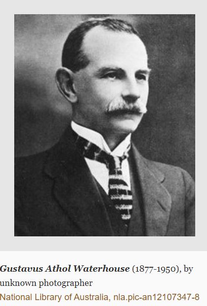
Gustavus Athol Waterhouse (1877-1950) was an entomologist and brother to E. G.Waterhouse, of ‘Eryldene’, Gordon. Graduating with first-class honours in geology and palaeontology in 1899, he was influenced by Professor (Sir) Edgeworth David and studied volcanic dykes in the Triassic rocks around Sydney.
He lived in Stanhope Road, Killara with his wife Beatrice where he cultivated native plants, bred butterflies and carried out hybridization experiments. He was a member of the Field Naturalists’ Society, the Linnean Society, Royal Society and president of the Royal Zoological Society of NSW (1924-25).
He had an extensive butterfly collection and authored books on Australian butterflies.
Swamp Oak Floodplain Forest
- Swamp Oaks and Swamp Paperbarks dominate Swamp Oak Floodplain Forest (SOFF) in moist areas close to rivers and estuaries. Other species such as Lilly Pilly, Cheese Tree, Common Silkpod and Slender Knotwood thrive in SOFF.
- Swamp Oak Floodplain fact sheet
- These forests provide important wildlife corridors and winter feed trees for many mammals and birds, especially cockatoos.
- SOFF has been threatened by land clearing, weeds, water pollution and changes to soil salinity. It has been estimated that less than 30 per cent of original coastal floodplain wetlands, including SOFF, now remain. Remaining patches within Ku-ring-gai and are found adjacent to Middle Harbour in East Killara, East Lindfield and Roseville Chase, the Lane Cover River at Lindfield and at Bobbin Head in North Turramurra.
Coastal Upland Swamp
Swamp Oaks and Swamp Paperbarks dominate Swamp Oak Floodplain Forest (SOFF) in moist areas close to rivers and estuaries. Other species such as Lilly Pilly, Cheese Tree, Common Silkpod and Slender Knotwood thrive in SOFF.
Swamp Oak Floodplain fact sheet
These forests provide important wildlife corridors and winter feed trees for many mammals and birds, especially cockatoos.
SOFF has been threatened by land clearing, weeds, water pollution and changes to soil salinity. It has been estimated that less than 30 per cent of original coastal floodplain wetlands, including SOFF, now remain. Remaining patches within Ku-ring-gai and are found adjacent to Middle Harbour in East Killara, East Lindfield and Roseville Chase, the Lane Cover River at Lindfield and at Bobbin Head in North Turramurra.
Why do forests matter?
Forest are critical for both environmental health and human well-being. They provide habitat to over half of the world’s terrestrial species. They play a pivotal role in combating climate change through n carbon storage and reducing the concentration of greenhouse gases in the atmosphere, thus averting more extreme global temperature rises.
We cannot have a sustainable future without forests and they play an indispensable role in meeting international climate goals and limiting global warming to 1.5°C.
Forests also provide a multitude of benefits that are crucial for the health of our planet and our well-being. Forests protect us during extreme weather conditions, such as storms and floods. Their ecosystems supply us withh clean drinking water.
Urgent action is needed now more than ever
Despite these benefits, the world faces the challenge of ongoing deforestation, which is a major contributor to as much as 21% of total greenhouse gas emissions attributed to the agriculture, forestry and other land use sector. The impact of deforestation is profound, undermining climate resilience efforts.
Yet, to fully unleash forests’ mitigation potential and contribute to Paris commitments and biodiversity targets, a coherent planning and financing pathway is essential. This need becomes even more pressing as we approach key milestones such as COP30, aiming for significant progress in forest conservation and climate action by 2030.
Investing in forests not only addresses climate change and biodiversity loss.
The Australian government is investing in renewable energy to get us to net zero. However, it fails to see the critical role of forests.
Forests need to become a universal political priority.
Learn more about the state of forests here.
Learn more about the importance of forests here.
22 May 2020 Report The State of the World’s Forests: Forests, Biodiversity and People
Authors: UN Environment Programme (UNEP), Food and Agriculture Organization of the United Nations (FAO)
As we were putting the finishing touches to The State of the World’s Forests 2020 (SOFO), the world came face to face with the unprecedented challenges of the COV ID-19 pandemic. While the immediate global priority is to tackle this public health emergency, our long-term response must also address the underlying causes of such a pandemic.
Read report
The degradation and loss of forests is one such contributing factor, disrupting nature’s balance and increasing the risk and exposure of people to zoonotic diseases. Understanding and keeping track of the state of our world’s forests has never been so important.
State of the worlds forestsDownload
Lindfield


Two Creeks Track
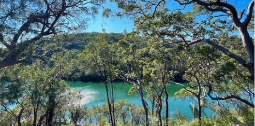
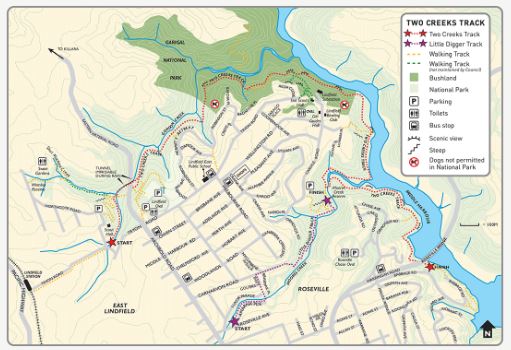
Start/finish: Begins at the corner of Slade Avenue and Tryon Road, East Lindfield. If you begin the walk here, you need to pass under Eastern Arterial Road via the stormwater tunnel, which may not be passable after rain. Alternatively, you can access the walk from the corner of Tryon Road and Eastern Arterial Road near Lindfield Oval. The track ends at Roseville Bridge but alternatives are possible (see map below), making your walk a circuit and returning to Lindfield Oval.
This long walk circles East Lindfield, descending beside Gordon Creek to Middle Harbour and continuing along Middle Harbour to Roseville Bridge. Along the way you will see post-war cobbled tracks and stonework, views of mangrove forests, salt marsh and sweeping water vistas and vegetation communities ranging from moist gullies to Sydney sandstone gully bushland.
Distance: 6 km
Duration: 2 hrs one way
Difficulty: Moderate – steep, rough sections and steps
For more information visit HERE


Lindfield Railway Station is in close proximity to the Pacific Highway.
Lindfield Railway Station is part of a north-south environmentally sensitive corridor.
This wildlife corridor supports biodiversity including its Critically Endangered Blue Gum High Forest and Sydney Turpentine Ironbark Forest (STIF).
Ku-ring-gai has four endangered ecological communities and two critically endangered, under the NSW Biodiversity Conservation Act 2016.
An ecological community is listed as critically endangered if the Threatened Species Scientific Committee (TSSC) determines it is facing an extremely high risk of extinction in Australia in the immediate future.
Threats to these communities have been the result of clearing, fragmentation and pressures from the surrounding environment, such as weeds, nutrient run off and sedimentation.
Urban deforestation is being fuelled by the NSW Government State Environment Planning Policies – or SEPPs – (Transport Oriented Development, Low to Mid Rise Housing, State Significant Planning Developments, Housing Delivery Authority).
Environmentally sensitive railway corridor
Climate Change
Climate change refers to long-term shifts in temperatures and weather patterns. Human activities have been the main driver of climate change, primarily due to the burning of fossil fuels like coal, oil and gas.
2025 is a critical year for climate action, as governments submit a third round of five-year national climate plans (NDCs) ahead of the UN Climate Change Conference in Belem (COP30). 2025 will also mark the 10th anniversary of the Paris Agreement.
Without intensified efforts, current projections show that global temperatures could rise by 2.6–3.1°C above pre-industrial levels by the end of the century. While this is a marked improvement from the 5°C increase projected in 2010, the world remains far from the 1.5°C Paris Agreement goal.
Restoring forest ecosystems improves water resources and reduces natural disasters while investing in climate-resilient buildings cuts emissions and protect people from extreme weather events.
Buildings & construction is by far the largest emitter of greenhouse gases
2025, UNEP is keen to promote governments who are developing and implementing innovative and sustainable solutions and policies that drive climate action and deliver positive benefits to people’s health and well-being. 2025 focuses on solutions relating to buildings and construction (as well as methane, sustainable cooling including energy efficiency, clean air, and forests).
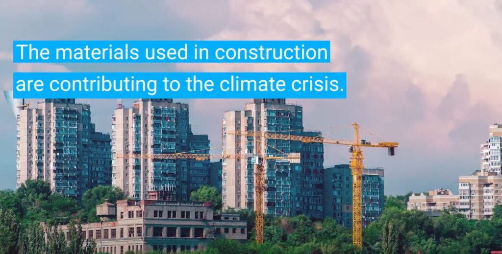
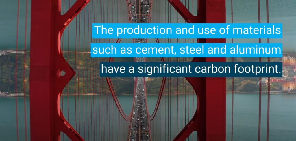
Buildings and construction sector is by far the largest emitter of greenhouse gases. The production and use of materials such as cement, steel, and aluminum have a significant carbon footprint.
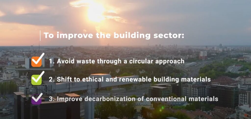
‘Building Materials and the Climate: Constructing a New Future’, a report developed by UNEP, Yale CEA in the framework of the Global Alliance for Buildings and Construction (GlobalABC), highlights the urgent need to develop new models for cooperation on the decarbonisation of building material. The report also lays out policy recommendations to galvanize rapid action on decarbonising building materials through a three-pronged solution (“Avoid-Shift-Improve”).
This report highlights the urgent need to develop new models for cooperation on the decarbonisation of building materials, if the world is to reach its goals for net zero emissions from the built environment sector by the mid-century. It focuses on three urgent pathways that must be facilitated by supporting stakeholders across the lifecycle of the built environment sector in order to decarbonise: i) AVOID extraction and production of raw materials by galvanising a circular economy; ii) SHIFT to regenerative material practices wherever possible by using ethically produced low carbon earth- and bio-based building materials whenever possible; and iii) IMPROVE methods to radically decarbonise conventional materials.


Mental Health
Energy of lifts and dryers
Roseville


Roseville Railway Station is in close proximity to the Pacific Highway.
Roseville Railway Station is part of a north-south environmentally sensitive corridor.
This wildlife corridor supports biodiversity including its Critically Endangered Blue Gum High Forest and Sydney Turpentine Ironbark Forest (STIF).
The station is part of Ku-ring-gai’s Green Corridors, supporting biodiversity including its Critically Endangered Blue Gum High Forest and Sydney Turpentine Ironbark Forest (STIF).
The western side of the Pacific Highway ridgeline drops steeply down to Lane Cove National Park.
Ku-ring-gai has four endangered ecological communities and two critically endangered, under the NSW Biodiversity Conservation Act 2016.
An ecological community is listed as critically endangered if the Threatened Species Scientific Committee (TSSC) determines it is facing an extremely high risk of extinction in Australia in the immediate future.
Threats to these communities have been the result of clearing, fragmentation and pressures from the surrounding environment, such as weeds, nutrient run off and sedimentation.
Urban deforestation is being fuelled by the NSW Government State Environment Planning Policies – or SEPPs – (Transport Oriented Development, Low to Mid Rise Housing, State Significant Planning Developments, Housing Delivery Authority).
Environmentally sensitive railway corridor
What happens on the land impacts on the oceans and our beaches
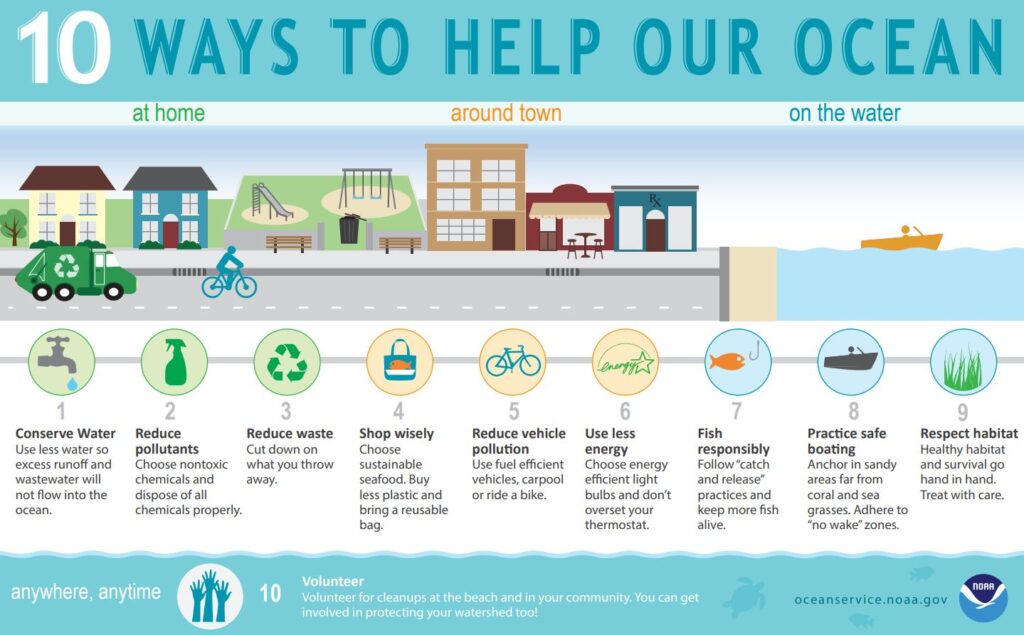
Source: https://cdn.oceanservice.noaa.gov/oceanserviceprod/ocean/help-our-ocean.pdf
What we do on the land significantly impact oceans through pollution, climate change and habitat destruction.
Urban run-off, sewage effluent discharges and plastic waste, contaminate creeks, rivers, Sydney Harbour waterways, beaches and oceans. Climate change, driven by human activities, also affects oceans through warming, acidification, and sea-level rise, further impacting marine habitats and biodiversity.
Water quality is degraded in many areas by high nutrient and sediment loads, heavy metals, chemical pollutants, faecal bacteria and organic wastes, and periodically does not comply with guidelines for protection of aquatic ecosystems. The largest impacts have been caused by elevated nutrient levels and sedimentation and include widespread loss of seagrass beds and eutrophication of coastal waters. Parallel losses in invertebrates and fish have been linked to declines in coastal fisheries, while algal blooms include toxic species that have contaminated shellfish and pose human health threats. loss and smothering, further reducing nursery areas for coastal fish.
The most impacted areas occur adjacent to major coastal cities, where pollutants enter the sea via a wide range of point and diffuse sources and habitats have been highly modified through urban development.
Northern Sydney’s major sewerage outfall, the Northern Suburbs Ocean Outfall Sewer (NSOOS), is located at North Head. The NSOOS transports wastewater from the northern suburbs, including areas as far west as Blacktown, to the North Head Water Resource Recovery Facility.
Raw sewage discharges during heavy rainfalls remain a problem due to overloading of treatment plants and illegal
stormwater connections and often can close Sydney beaches.
Duffys Forest Ecological Community
Duffys Forest Ecological Community (EC) ranges in height from 11 – 20 metres, dominated by Red Bloodwoods, Black Ash, Smooth-barked Apple and Stringybarks. It is also home to threatened plant species including Port Jackson Heath, Caley’s Grevillea, Curved Rice Flower, Hairy Geebung and Glandular Pink-bell.
View Duffys Forest EC fact sheet(PDF, 683KB)
The forest provides layers of habitat for a range of native wildlife.
Only 15 per cent of the original Duffys Forest EC now remains, mainly in Warringah and Ku-ring-gai.
Estuarine saltmarsh
Estuarine saltmarsh is usually found behind mangroves in tidal areas. Salt-tolerant communities of herbs, grasses, rushes, sedges and reeds provide food and habitat for fish, crabs, birds, molluscs, insects and spiders. Saltmarsh is threatened due to changes in sediment and tidal flow, stormwater run-off, weeds, human disturbance and climate change.
Saltmarsh fact sheet(PDF, 462KB)
Saltmarsh are important to fish as they provide sources of food, habitat and shelter when inundated at high tide. Crabs are common in saltmarsh communities and are a significant food for several fish species.
In Ku-ring-gai you can find small pockets of saltmarsh in the tidal areas of Middle Harbour, usually around creek outlets such as Northern Creek, Southern Creek, Gordon Creek and Moores Creek.
Return train to Gordon
View from train.
Gordon
SUMMARY: Key Issues from Friends of Ku-ring-gai Environment (FOKE) on Ku-ring-gai Council’s TOD Alternative
- Abandoning Federal, NSW and local environmental protections
FOKE is gravely concerned about the environmental impacts of the Preferred Scenario (pressured by DPHI and to be approved by NSW Minister for Planning) on Ku-ring-gai’s critically endangered ecological communities, including the Blue Gum High Forest and Sydney Turpentine Ironbark Forest, both listed as critically endangered under state and federal legislation.
The intensified development risks further loss of tree canopy, vital for maintaining Ku-ring-gai’s biodiversity and mitigating urban heat. FOKE warns that clearing or fragmentation of these habitats, even indirectly through expanded development zones, could accelerate biodiversity extinction, threatening native species such as powerful owls, microbats, and other flora and fauna dependent on these ecosystems. The lack of comprehensive environmental studies exacerbates these risks, leaving Ku-ring-gai’s ecological assets vulnerable. - Climate Threats, Particularly Bushfire Risks
FOKE is deeply concerned about the climate-related risks posed by Preferred Scenario (pressured by DPHI and to be approved by NSW Minister for Planning), particularly the increased bushfire threat in Lindfield due to its proximity to bushland and the presence of dense vegetation, including Blue Gum High Forest and Sydney Turpentine Ironbark Forest. The intensification of development, with high-density buildings up to 800m from the station, could heighten bushfire risks by placing more residents in fire-prone areas without adequate mitigation measures. FOKE argues that the absence of climate risk assessments, including bushfire hazard studies, in the TOD planning process endangers Lindfield’s community and undermines resilience to climate-driven extreme weather events.
Ku-ring-gai is the ‘lungs of Sydney’. Ku-ring-gai’s giant trees keep Sydney cool. More important than ever with extreme heat waves. - Insufficient Environmental Studies
FOKE emphasizes the absence of critical ecological studies risking unsustainable development, straining local infrastructure and exacerbating environmental degradation. No sufficient studies on the cumulative impact of increased housing densification across Greater Sydney and how Sydney is an integrated landscape. Nor are there any population studies assessing the impact of the NSW Government’s Transport Oriented Development (TOD) rezoning between Roseville to Gordon that demands an additional 23,200 dwellings (estimated 60,000+ additional residents) that will be built over the next 20 years and which will irreversibly transform Ku-ring-gai that will be unrecognisable to what we see today. - Is the NSW Government gas lighting Ku-ring-gai about its environmental sensitivity. At the moment the NSW Government is in denial about the importance of protecting urban environments and particularly Ku-ring-gai – one of the most environmentally sensitive areas in Sydney.
- Other issues: Cumulative impact; Zoning as a key threatening process; Urban forests – hollows – remnant forests
UPCOMING FORUM: PLASTIC TURF DANGERS
TUES 10 June 2025, 6-9pm, Ku-ring-gai Town Hall, 1186 Pacific Hwy, Pymble
For more information contact: Kristyn Haywood, Convenor Voices of Ku-ring-gai enquiry@voicesofkuringgai.org
In 2023 scientists presented evidence about the dangers of placing plastic turf on the Norman Griffith Oval, West Pymble at the Ku-ring-gai Town Hall. Regrettably Ku-ring-gai Council did not listen to this evidence and community concerns.
The community then took Ku-ring-gai Council to Court in an attempt to protect the surrounding Sydney Turpentine Ironbark Forest and nearby Quarry Creek, surrounding the Normann Griffith Oval. Despite an excellent case, the community lost the court case.
Ku-ring-gai Council has recently announced they have terminated the contract with Turf One and are now looking into other options. $7 million + has already been spent on the project to put artificial turf on Norman Griffith Oval.
Forum will discuss:
- new ways to build climate-resilient, high-quality sporting fields.
- the NSW Government’s new Best-Practice Guidelines for Sporting Fields
- expert insights from the latest AgEnviro and Natural Turf Alliance
- progress on the Norman Griffiths Oval and other synthetic and natural turf field projects
- the environmental, health, and community risks of synthetic fields
- practical next steps for securing greener, safer public spaces for future generation.
PLEASE write a letter about what you have learnt on this walk to:
- Chris Minns NSW Premier office@premier.nsw.gov.au
- Paul Scully NSW Planning Minister Paul Scully: https://www.nsw.gov.au/nsw-government/ministers/minister-for-planning-and-public-spaces
- Mark Speakman NSW Leader of Opposition: Liberal.Leader@parliament.nsw.gov.au
- Scott Farlow Shadow NSW Planning Minister scott.farlow@parliament.nsw.gov.au
- Matt Cross, MP for Davidson (Roseville, Lindfield, Killara & Gordon) davidson@parliament.nsw.gov.au
- Cr Barbara Ward (Gordon Ward) bward@krg.nsw.gov.au Mobile: 0447 081 824
- Cr Indu Balachandran (Gordon Ward) ibalachandran@krg.nsw.gov.au Mobile: 0457 411 083
- Ku-ring-gai Councillors councillors@krg.nsw.gov.au
- Ku-ring-gai Council: krg@krg.nsw.gov.au
- National Trust (NSW) Board of Directors info@nationaltrust.com.au
- Sign onto Save Greater Sydney Coalition email savegreatersydneycoalition2@gmail.com
- Send your photos of this walk to Friends of Ku-ring-gai Environment (FOKE) info@foke.org.au
- Send copies or your letters to FOKE info@foke.org.au
- Sign onto receiving FOKE Newsletters HERE
- Join FOKE as a member. Details at www.foke.org.au
Dear …………………………….
On Thursday 5 June 2025, I attended Friends of Ku-ring-gai Environment’s (FOKE) World Environment Day that celebrated Sydney’s environmental heritage – Ku-ring-gai.
During this walk I was distressed to learn …………………………………, amazed to discover ……………………………. and very concerned about ……………………………………I respectfully ask you to ……………………………………….
Yours sincerely
……………………………………….
References
Defining Moments Influenza pandemic, National Museum Australia HERE
IMPACT FROM THE OCEAN/LAND INTERFACE HERE
Charles Musson HERE
Gustavus Athol Waterhouse HERE
Grey-headed flying fox HERE
appendix-4-land-eco-consulting-independent-assessment-of-potential-


Stay in Touch
Sign up for FOKE E-News HERE
info@foke.org.au
https://www.facebook.com/friendsofkuringgai/
Pages: 1 2